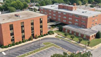
New Bern Ave. & Person St.1 SE Corner
New Bern Ave. & Person St.1 SE Corner:
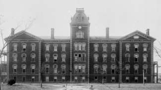
Shaw University: Historic Hwy. Marker 11-32 on South Street: "Baptist Institution for Negroes, begun 1865, chartered 1875, founded by Henry Martin Tupper, named for Elijah Shaw of Wales, Massachusetts." Historic African American college located seven blocks southwest, at 118 E South St. Oldest campus building, Estey Hall, built in 1874, is the first building in the United States constructed for the higher education of black women. Leonard Medical School, established in 1881, was the first four-year medical school in North Carolina, 1881 classroom building and 1920 hospital building still stand on S. Wilmington Street.
New Bern Ave. & Bloodworth St., NW Corner
New Bern Ave. & Bloodworth St., NW Corner:
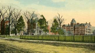
Oakwood Historic District, developed four blocks north from about 1870 to 1900 as the earliest subdivision outside of original city limits. Listed on the National Register of Historic Places in 1974 and designated a Raleigh Historic District by City Council in 1975.
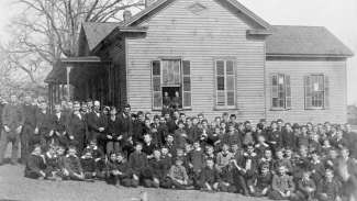
Raleigh Male Academy, ca. 1884 - Edenton St. & Bloodworth SI., NE Corner
Edenton St. & Bloodworth SI., NE Corner:
Raleigh Male Academy, ca. 1884. This important school for boys took up the entire North side of Edenton St. between Bloodworth and East. It relocated here about 1884 when it lost its campus on Burke Square in 1883 when the Executive Mansion was built.
New Bern Ave. & East St, NW Corner
New Bern Ave. & East St, NW Corner:
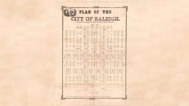
Eastern boundary of the original City of Raleigh. The original city plan, drawn by surveyor and legislator William Christmas in 1792, contained four hundred acres, with North, South, East and West streets as the boundaries. Christmas's plan called for New Bern Ave, and the other 3 streets leading toward Union Square to be 99 ft. wide, the rest of the streets to be 66 ft. wide. Raleigh grew slowly, and by 1891 the eastern boundary was one and one-half blocks east of here.
New Bern Ave. & East St., SE Corner 500 block New Bern Avenue
New Bern Ave. & East St., SE Corner 500 block New Bern Avenue:
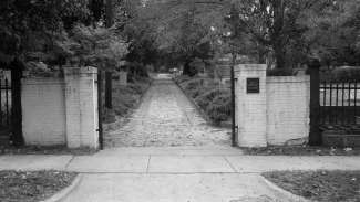
City Cemetery occupies much of the block south to E. Hargett St. 1798. Originally four-acre plot later designated two one-acre plots for citizens, one for “strangers” and one for blacks, mainly slaves. Boundaries were extended in mid-19th c. by 3.3 acres. The iron fence was cast by Silas Burns, who established Raleigh's first iron foundry. The iron fence that was erected around the State Capitol in 1847 and was moved here to City Cemetery about 1900. William Stronach, Scottish-born stonecutter who came to Raleigh to work on the State Capitol, cut the granite base of the fence. Stronach opened the first marble yard in Raleigh, and carved gravestones from his home and marble yard on Hargett St. opposite the City Cemetery.
New Bern Ave. & Ray St., NW Corner:
Henry Porter House, 555 New Bern Avenue. Before 1850. Two-story Greek Revival style house built for Henry Porter, a prominent 19th century merchant who owned a Bootery and shoe store. Designated Raleigh Historic Property in 1979.
New Bern Ave. & Swain St., NW Corner:
Hungry Neck: The area to north, up to St. Augustine's College, between East and Swain streets, New Bern and Oakwood Avenue, was called by this name in early 1900s by African-Americans who lived here.
New Bern Ave. & Cooke St., NW Corner:
Experimental Railroad, 1832. This is the route of the "experimental railroad" built by Raleigh businessmen built in 1832 from the state stone quarry on Rock Quary Road to Union Square, a distance of 1 1/4 miles. Stone used to build the Capitol was hauled along the rails in box cars pulled by horse or mules. This railroad in North Carolina’s first started the push for railroads with steam-powered trains.
Edenton St. & Idlewild Ave., SW Corner:
ldlewild Neighborhood, 1891. ldlewild Avenue is the center of ldlewild, an early area of African-American home ownership, named after the battle family estate on cotton place sought of New Bern Avenue. The Raleigh Land and Improvement Company subdivided ldlewild, and it grew in the early twentieth century. Bounded by Swain St. on west, Oakwood Avenue on north, Tarboro Rd. on east and Edenton St. on south.
New Bern Ave. & N. State St., NE Comer
New Bern Ave. & N. State St., NE Comer:
Raleigh Primitive Baptist Church. NE corner N. State St. and New Bern Avenue. Relocated to current site from Moore Square area in 1850's.
New Bern Ave. & Tarboro St., SW Corner
New Bern Ave. & Tarboro St., SW Corner:
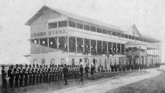
Old Fairgrounds: the State fair was held here, October 18-21, 1853." Hwy. Marker h-45 "First racetrack was two blocks south on New Bern Avenue and corner of Tarboro Rd. between Hargett and Davie Streets, site of Dept. of Motor Vehicles. The State Fair operated from 1853 to 1872, with exception of Civil War years, when it served as a military training camp. The Fair Grounds Hospital, the first military hospital in North Carolina, was established here in 1861.
New Bern Ave. & Tarboro St. NW Corner
New Bern Ave. & Tarboro St. NW Corner:
Stone Quarry early 19th century. The site of the state stone quarry is four blocks south, between Davie Street and Rock Quarry Road where Lucille Hunter School was built in the 1920s. The fine-grained light gray granite used to construct the State Capitol from 1833-1840 came from this quarry.
New Bern Ave. & Tarboro St., SE Corner:
“Raleigh baseball park 1930s and 1940s. The city baseball field stood here until the 1940s. Four blocks south are the seven landscaped acres of the national cemetery. Authorized by Congress on February 23, 1867 graves of Union soldiers killed in war between the states veterans of Spanish-American War. World Wars I and II. Korean and Vietnam Wars.”
Edenton St. & Tarboro Rd., NW Corner
Edenton St. & Tarboro Rd., NW Corner:
St. Augustine's College: 1315 Oakwood Avenue. Hwy Marker H-96: "Founded in 1867 by the Episcopal Church and Freedman’s Bureau as a normal school (teacher education) for freedmen. Since 1928 a four-year college. 4 blocks N." Historic African American college that attracted many blacks in search of an education to Raleigh in the late 1800s and early 1900s. The college has been the center of the of the thriving neighborhoods Idlewild and College Park during the twentieth century.
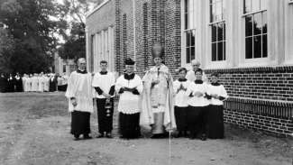
St. Monica's Catholic School, operated ca. 1929 - 1960 to serve African-American children. Brick and concrete building of Neo-Gothic design. The Catholic sisters who taught the school had a strong influence of many American children during this period.
Edenton St. & Tarboro Rd., NE Corner:
O'Rourke Cemetery, N. Tarboro Street. 1858. Land for this Catholic Cemetery was donated by a prominent Raleigh Catholic John O'Rourke, whose house stood nearby, in 1858.
Edenton St. and Pettigrew St:
College Park earlier known as Lincoln Park bounded by Tarboro Rd. on West, Glascock St. on North, New Bern Avenue on the South. This 1920s neighborhood took its name from St. Augustine’s College on its Northern boundary, and was one of the early areas of African-American home ownership.